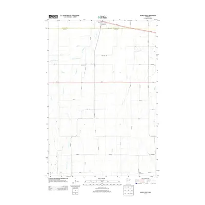
2013 Map of Aldrich South
USGS Topo · Published 2013About this map
Aldrich sits along the northern edge of this landscape, positioned where Us-10 and the Partridge River intersect. This area is characterized by a dense network of country roads and several meandering waterways, including Little Partridge River, Egly Cr, and Moran Cr. The topography reveals the agricultural and rural nature of the border between Wadena Co and Todd Co. Genealogists and local historians will find significant value in the documentation of the Balsamlund Cem in the northwest and the Moran Germania Cem at the southern boundary. The road system, marked by local identifiers like Thorn Apple Rd and Todd Line Rd, provides a precise layout of the rural parcels and transport routes connecting the small settlement of Aldrich to the surrounding townships in the early 21st century.
Find a feature on this map
41 named features on this map. Tap any name to fly to it.
Don’t see what you’re looking for? This feature index may not catch every label — zoom into the map to look around manually.
Map Details
Editions of this 2013 Aldrich South Map
This is the sole edition of this map. No revisions or reprints were ever made.
Other maps of this area

1953 · Brainerd
USGS Topo · 1:250,000

1957 · Brainerd
USGS Topo · 1:250,000

1958 · Brainerd
USGS Topo · 1:250,000

1965 · Brainerd
USGS Topo · 1:250,000

1966 · Staples NE
USGS Topo · 1:24,000
1966 · Browerville NE
USGS Topo · 1:24,000

1966 · Staples
USGS Topo · 1:24,000

1966 · Aldrich North
USGS Topo · 1:24,000
1966 · Clarissa
USGS Topo · 1:24,000

1966 · Aldrich South
USGS Topo · 1:24,000