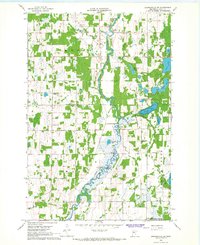
1966 Map of Browerville NE
USGS Topo · Published 1967About this map
The Long Prairie River winds through the heart of the Moran and Ward townships, shaping a landscape defined by its glacial hydrology and mid-century rural infrastructure. This 1966 survey documents a network of isolated rural schools, including School No 2297 and School No 2348, which served the farming families of Todd County. Local spiritual and communal life is anchored by landmarks like St Isidore Ch and the Swedish Cem, offering valuable data for genealogists tracing Scandinavian or Catholic heritage in the region. The map also captures the early footprints of conservation efforts with the Long Prairie State Wildlife Management Area and Turtle Creek State Wildlife Management Area, preserving the wetlands surrounding Dempsey Lake and Turtle Lake. Scattered gravel pits across the terrain indicate the local extractive industry that supported the development of the township road grid.
Find a feature on this map
27 named features on this map. Tap any name to fly to it.
Don’t see what you’re looking for? This feature index may not catch every label — zoom into the map to look around manually.
Map Details
Editions of this 1966 Browerville NE Map
This is the sole edition of this map. No revisions or reprints were ever made.
Other maps of this area

1948 · Cushing
USGS Topo · 1:62,500

1950 · Cushing
USGS Topo · 1:62,500

1953 · Brainerd
USGS Topo · 1:250,000

1957 · Brainerd
USGS Topo · 1:250,000

1958 · Brainerd
USGS Topo · 1:250,000

1963 · Motley
USGS Topo · 1:24,000

1965 · Brainerd
USGS Topo · 1:250,000
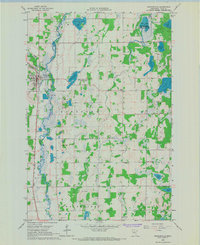
1966 · Browerville
USGS Topo · 1:24,000

1966 · Staples
USGS Topo · 1:24,000
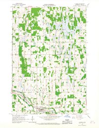
1966 · Clarissa
USGS Topo · 1:24,000