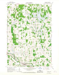
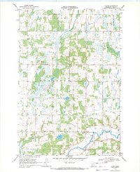
1966 Map of Clarissa
USGS Topo · Published 1967About this map
Clarissa sits at the intersection of a central rail corridor and the surrounding agricultural townships in the mid-1960s. The village is anchored by the Great Northern railroad line, which runs parallel to Eagle Creek and serves a landscape defined by small-scale farming and drainage management, as evidenced by County Ditch No 31 and County Ditch No 35. This survey captures the social fabric of the rural landscape through its distribution of neighborhood landmarks, including School No 2282 and several distinct religious sites like the Scandinavian Ch and Bethlehem Ch. A high concentration of burial sites, such as St Joseph Cem, Woodmans Cem, and St Matthews Cem, offers a detailed spatial record for genealogists studying the families of Germania, Eagle Valley, and Moran townships.
Find a feature on this map
23 named features on this map. Tap any name to fly to it.
Don’t see what you’re looking for? This feature index may not catch every label — zoom into the map to look around manually.
Map Details
Editions of this 1966 Clarissa Map
This is the sole edition of this map. No revisions or reprints were ever made.
Other maps of this area

1953 · Brainerd
USGS Topo · 1:250,000

1957 · Brainerd
USGS Topo · 1:250,000

1958 · Brainerd
USGS Topo · 1:250,000

1965 · Brainerd
USGS Topo · 1:250,000
1966 · Browerville
USGS Topo · 1:24,000
1966 · Browerville NE
USGS Topo · 1:24,000

1966 · Staples
USGS Topo · 1:24,000
1966 · Browerville SW
USGS Topo · 1:24,000

1966 · Aldrich South
USGS Topo · 1:24,000
1969 · Clotho
USGS Topo · 1:24,000