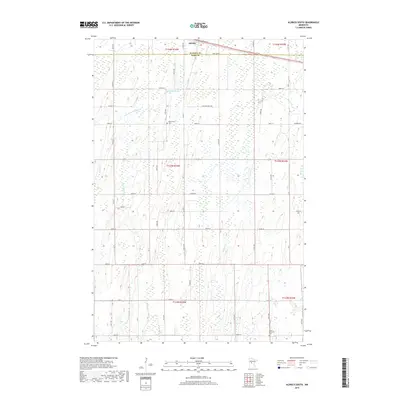
2019 Map of Aldrich South
USGS Topo · Published 2019About this map
Aldrich sits along the northern edge of this map, situated where the Wadena and Todd county lines meet. This landscape is defined by the slow drainage of the Partridge River and its tributary, the Little Partridge River, which wind through a patchwork of wetlands and low-lying agricultural fields. Further east, Moran Cr and Eagle Cr provide additional drainage for the rural sections. The map reveals the quiet, persistent markers of local history through its small cemeteries, including Balsamlund Cem near the center and the Moran- Germania Cem in the southeast. A dense grid of rural roads, such as Main St E, Todd Line Rd, and numerous numbered avenues like 181st Ave, connects the scattered farmsteads and rural properties that characterize this part of central Minnesota.
Find a feature on this map
45 named features on this map. Tap any name to fly to it.
Don’t see what you’re looking for? This feature index may not catch every label — zoom into the map to look around manually.
Map Details
Editions of this 2019 Aldrich South Map
This is the sole edition of this map. No revisions or reprints were ever made.
Other maps of this area

1953 · Brainerd
USGS Topo · 1:250,000

1957 · Brainerd
USGS Topo · 1:250,000

1958 · Brainerd
USGS Topo · 1:250,000

1965 · Brainerd
USGS Topo · 1:250,000

1966 · Staples NE
USGS Topo · 1:24,000
1966 · Browerville NE
USGS Topo · 1:24,000

1966 · Staples
USGS Topo · 1:24,000

1966 · Aldrich North
USGS Topo · 1:24,000
1966 · Clarissa
USGS Topo · 1:24,000

1966 · Aldrich South
USGS Topo · 1:24,000