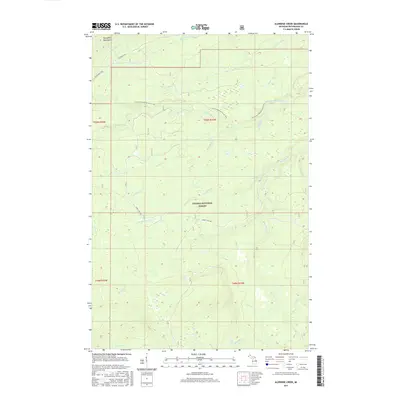
2017 Map of Aldridge Creek
USGS Topo · Published 2017About this map
Ottawa National Forest dominates this section of the Upper Peninsula, where the landscape is defined by the complex drainage systems feeding into the iron rivers. The map traces the rugged path of the N Country National Scenic Trail as it winds through the interior toward the Porcupine Mountains in the northwest. Water is the primary feature of this terrain, with the Big Iron River and its numerous tributaries, such as Aldridge Creek and McFarland Cr, carving through the forest. Significant vertical drops in the landscape are noted at Deer Creek Falls and Rapid River Falls in the southern portion of the quadrangle. This 2017 survey reflects a largely undeveloped wilderness managed for conservation and recreation, accessed primarily via routes like Forest Hwy 360 and S Boundary Rd.
Find a feature on this map
31 named features on this map. Tap any name to fly to it.
Don’t see what you’re looking for? This feature index may not catch every label — zoom into the map to look around manually.
Map Details
Editions of this 2017 Aldridge Creek Map
This is the sole edition of this map. No revisions or reprints were ever made.
Other maps of this area

1949 · White Pine
USGS Topo · 1:24,000

1949 · Bergland NE
USGS Topo · 1:24,000

1956 · Carp River
USGS Topo · 1:62,500

1956 · Bergland NE
USGS Topo · 1:24,000

1956 · Bergland
USGS Topo · 1:62,500

1956 · Thomaston
USGS Topo · 1:62,500

1956 · White Pine
USGS Topo · 1:24,000

1956 · White Pine
USGS Topo · 1:62,500

1958 · Iron River
USGS Topo · 1:250,000

1960 · Iron River
USGS Topo · 1:250,000