
1949 Map of White Pine
USGS Topo · Published 1949About this map
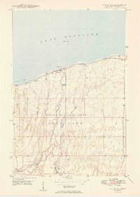
Lake Superior defines the northern coastline of this 1949 survey, where the small settlement of Silver City sits at the mouth of the Iron River along Union Bay. The landscape transitions from the shoreline into the heavily wooded interior of the Ottawa National Forest, a terrain marked by deep river valleys and industrial outposts. The map documents the early infrastructure of the region's mining and logging history, featuring isolated locations like Greenwood Camp, Sterling Camp, and the settlement of None Such near the mountains. The southern portion of the quadrangle is anchored by White Pine, showing the layout of the area before significant mid-century industrial expansion. This record is particularly valuable for tracing the development of Porcupine Mountain State Park and the network of waterways, including the Mineral River and Little Iron River, that shaped the local economy.
Find a feature on this map
21 named features on this map. Tap any name to fly to it.
Don’t see what you’re looking for? This feature index may not catch every label — zoom into the map to look around manually.
Map Details
Editions of this 1949 White Pine Map
2 editions found
Other maps of this area

1949 · Matchwood NW
USGS Topo · 1:24,000

1949 · Bergland NE
USGS Topo · 1:24,000

1955 · Ontonagon
USGS Topo · 1:62,500

1956 · Bergland NE
USGS Topo · 1:24,000

1956 · Bergland
USGS Topo · 1:62,500

1956 · White Pine
USGS Topo · 1:24,000

1956 · Matchwood NW
USGS Topo · 1:24,000

1956 · White Pine
USGS Topo · 1:62,500

1956 · Matchwood
USGS Topo · 1:62,500

1958 · Iron River
USGS Topo · 1:250,000