
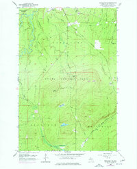
1956 Map of Bergland NE
USGS Topo · Published 1957About this map
The White Pine Mine and the adjacent settlement of White Pine define the northern industrial character of this landscape in the mid-1950s. Located south of Porcupine Mountains State Park, the terrain is heavily marked by the drainage systems of the Iron River and Mineral River. The mapping captures a network of resource extraction and transport, including the Duluth South Shore and Atlantic railway and an Old Railroad Grade that speaks to earlier logging or mining efforts.
Find a feature on this map
39 named features on this map. Tap any name to fly to it.
Don’t see what you’re looking for? This feature index may not catch every label — zoom into the map to look around manually.
Map Details
Editions of this 1956 Bergland NE Map
2 editions found
Other maps of this area

1949 · Matchwood NW
USGS Topo · 1:24,000

1949 · White Pine
USGS Topo · 1:24,000

1949 · Bergland NE
USGS Topo · 1:24,000

1955 · Ontonagon
USGS Topo · 1:62,500

1956 · Bergland
USGS Topo · 1:62,500

1956 · White Pine
USGS Topo · 1:24,000

1956 · Matchwood NW
USGS Topo · 1:24,000

1956 · White Pine
USGS Topo · 1:62,500

1956 · Matchwood
USGS Topo · 1:62,500

1958 · Iron River
USGS Topo · 1:250,000