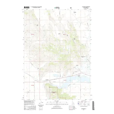
2017 Map of Alexander
USGS Topo · Published 2017About this map
Bear River drainage and historical migration corridors dominate this portion of Caribou County, where the settlement of Alexander sits at a critical junction of water and road. The landscape is a complex mix of volcanic history and early transport routes, evidenced by the Blackfoot Lava Field to the north and the nearby presence of Oregon Trail Rd and Hudspeths Cutoff Rd. These routes trace the path of nineteenth-century emigrants moving through the Upper Valley toward the Great Basin. Water management is central to the area's development, with the Soda Canal and Alexander Reservoir supporting local industry and agriculture. Notable natural landmarks like Soda Point and the elevations of the Ninety Percent Range provide a dramatic backdrop to Cache National Forest, while specific sites like Steamboat Spring and Stampede Park offer focal points for local history and recreation.
Find a feature on this map
47 named features on this map. Tap any name to fly to it.
Don’t see what you’re looking for? This feature index may not catch every label — zoom into the map to look around manually.
Map Details
Editions of this 2017 Alexander Map
This is the sole edition of this map. No revisions or reprints were ever made.
Other maps of this area

1914 · Henry
USGS Topo · 1:48,000

1916 · Henry
USGS Topo · 1:62,500

1917 · Portneuf
USGS Topo · 1:62,500

1948 · Bancroft
USGS Topo · 1:62,500

1948 · Soda Springs
USGS Topo · 1:62,500

1949 · Bancroft
USGS Topo · 1:62,500

1949 · Soda Springs
USGS Topo · 1:62,500

1955 · Preston
USGS Topo · 1:250,000

1958 · Preston
USGS Topo · 1:250,000

1962 · Preston
USGS Topo · 1:250,000