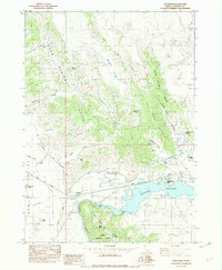
1982 Map of Alexander
USGS Topo · Published 1982About this map
The Union Pacific railroad and the historical route of the Oregon Trail converge near the settlement of Alexander, illustrating a landscape defined by both modern infrastructure and pioneer history. The impounded waters of the Alexander Reservoir dominate the southern topography, created by the Alexander Dam on the Bear River. This hydroelectric and irrigation development is supported by a network of canals, including the Int Soda Canal and the Double Wood Canal. Volcanic geology is evident in landmarks like the Alexander Crater and Old Crater, which stand in contrast to the agricultural activity at Idaho Ranch. The terrain rises sharply to the north and east through the Soda Springs Hills and the Ninety Percent Range, while Stampede Park and a Historical Mon. mark points of local cultural interest.
Find a feature on this map
31 named features on this map. Tap any name to fly to it.
Don’t see what you’re looking for? This feature index may not catch every label — zoom into the map to look around manually.
Map Details
Editions of this 1982 Alexander Map
This is the sole edition of this map. No revisions or reprints were ever made.
Other maps of this area

1914 · Henry
USGS Topo · 1:48,000

1916 · Henry
USGS Topo · 1:62,500

1917 · Portneuf
USGS Topo · 1:62,500

1948 · Bancroft
USGS Topo · 1:62,500

1948 · Soda Springs
USGS Topo · 1:62,500

1949 · Bancroft
USGS Topo · 1:62,500

1949 · Soda Springs
USGS Topo · 1:62,500

1955 · Preston
USGS Topo · 1:250,000

1958 · Preston
USGS Topo · 1:250,000

1962 · Preston
USGS Topo · 1:250,000