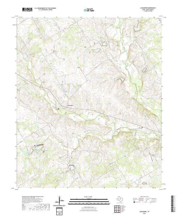
2022 Map of Alexander
USGS Topo · Published 2022About this map
Alexander serves as the primary community in this portion of Erath County, situated at a junction of roads and rail corridors that follow the natural contours of the Central Texas landscape. The drainage patterns of the N Bosque River and its various tributaries, such as Green Cr and Live Oak Cr, dictate the placement of local thoroughfares like FM 914 and Co RD 246.
Find a feature on this map
56 named features on this map. Tap any name to fly to it.
Don’t see what you’re looking for? This feature index may not catch every label — zoom into the map to look around manually.
Map Details
Editions of this 2022 Alexander Map
This is the sole edition of this map. No revisions or reprints were ever made.
Other maps of this area

1888 · Hamilton
USGS Topo · 1:125,000

1890 · Stephenville
USGS Topo · 1:125,000

1894 · Hamilton
USGS Topo · 1:125,000

1920 · Stephenville
USGS Topo · 1:125,000

1954 · Brownwood
USGS Topo · 1:250,000

1954 · Abilene
USGS Topo · 1:250,000

1956 · Gustine
USGS Topo · 1:62,500

1956 · Hico
USGS Topo · 1:62,500
1956 · Edna Hill
USGS Topo · 1:24,000
1956 · Carlton
USGS Topo · 1:24,000