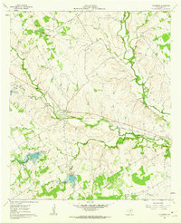
1961 Map of Alexander
USGS Topo · Published 1962About this map
The North Bosque River and its numerous tributaries, including Alarm Creek and Green Creek, dominate this central Texas landscape. In the early 1960s, the area's hydrology was being actively managed by the Brazos River Authority, as evidenced by several flood-control structures such as Green Creek Dam No 10 and Green Creek Dam No 13. The settlement of Alexander serves as a local hub, situated at the crossing of the Missouri Kansas Texas Railroad and several rural roads.
Find a feature on this map
29 named features on this map. Tap any name to fly to it.
Don’t see what you’re looking for? This feature index may not catch every label — zoom into the map to look around manually.
Map Details
Editions of this 1961 Alexander Map
This is the sole edition of this map. No revisions or reprints were ever made.
Other maps of this area

1888 · Hamilton
USGS Topo · 1:125,000

1890 · Stephenville
USGS Topo · 1:125,000

1894 · Hamilton
USGS Topo · 1:125,000

1920 · Stephenville
USGS Topo · 1:125,000

1954 · Brownwood
USGS Topo · 1:250,000

1954 · Abilene
USGS Topo · 1:250,000

1956 · Gustine
USGS Topo · 1:62,500

1956 · Hico
USGS Topo · 1:62,500
1956 · Edna Hill
USGS Topo · 1:24,000
1956 · Carlton
USGS Topo · 1:24,000