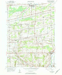
1949 Map of Alexander
USGS Topo · Published 1984About this map
Tonawanda Creek meanders across this corner of Genesee County, defining the settlement patterns of Alexander and East Pembroke in the post-war era. The landscape is heavily influenced by the intersections of major rail lines, including the New York Central, Lehigh Valley, and the Lackawanna and Western. These transit corridors shaped the small hamlets and agricultural crossroads of the 1940s, leaving a distinct footprint of depots and local station stops like Sawens (North Darien Sta).
Find a feature on this map
47 named features on this map. Tap any name to fly to it.
Don’t see what you’re looking for? This feature index may not catch every label — zoom into the map to look around manually.
Map Details
Editions of this 1949 Alexander Map
2 editions found
Other maps of this area

1897 · Albion
USGS Topo · 1:62,500

1897 · Medina
USGS Topo · 1:62,500

1904 · Batavia
USGS Topo · 1:62,500

1905 · Attica
USGS Topo · 1:62,500

1944 · Alexander
USGS Topo · 1:31,680

1949 · Attica
USGS Topo · 1:62,500

1949 · Alexander
USGS Topo · 1:24,000
1949 · Akron
USGS Topo · 1:24,000

1949 · Cowlesville
USGS Topo · 1:24,000
1949 · Attica
USGS Topo · 1:24,000