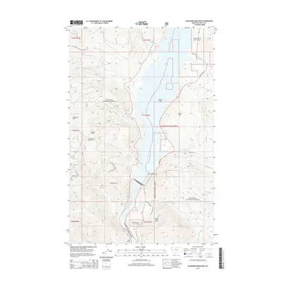
2014 Map of Alexander Mountain
USGS Topo · Published 2014About this map
Kootenai National Forest dominates this section of Lincoln County, where the steep terrain of the Purcell Mountains meets the wide expanse of the Kootenai River. The 2014 landscape is defined by Lake Koocanusa, a massive reservoir that altered the original river valley, creating features like Yarnell Island and the Kootenai Narrows. High elevations are marked by prominent summits such as Alexander Mtn and Fleetwood Point, while the hydrological network includes various drainage systems like Souse Cr and Jackson Cr. The map captures the specialized forest infrastructure required for this wilderness, including Natl Forest Develop Road 4864 Rd and Mount Hwy 37, which provides access to recreational and resource areas such as Dunn Creek Flats and the Koocanusa Marina Rd.
Find a feature on this map
36 named features on this map. Tap any name to fly to it.
Don’t see what you’re looking for? This feature index may not catch every label — zoom into the map to look around manually.
Map Details
Editions of this 2014 Alexander Mountain Map
This is the sole edition of this map. No revisions or reprints were ever made.
Other maps of this area

1920 · Jennings
USGS Topo · 1:125,000

1935 · Thompson Lakes
USGS Topo · 1:96,000

1942 · Thompson Lakes
USGS Topo · 1:125,000

1957 · Kalispell
USGS Topo · 1:250,000

1960 · Kalispell
USGS Topo · 1:250,000

1961 · Kalispell
USGS Topo · 1:250,000

1963 · Vermiculite Mountain
USGS Topo · 1:24,000

1963 · Swede Mountain
USGS Topo · 1:24,000

1963 · Banfield Mountain
USGS Topo · 1:24,000

1963 · Cripple Horse Mountain
USGS Topo · 1:24,000