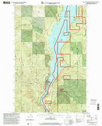
1997 Map of Alexander Mountain
USGS Topo · Published 2000About this map
Libby Dam and its complex infrastructure dominate this landscape within the Kootenai National Forest. The engineering of the dam transformed the Kootenai River into the expansive Lake Koocanusa, a reservoir that now defines the geography of the valley. Key facilities including the Powerhouse, Visitors Center, and Substation are clearly marked near the spillway, which sits at an elevation of 2472 feet.
Find a feature on this map
37 named features on this map. Tap any name to fly to it.
Don’t see what you’re looking for? This feature index may not catch every label — zoom into the map to look around manually.
Map Details
Editions of this 1997 Alexander Mountain Map
This is the sole edition of this map. No revisions or reprints were ever made.
Other maps of this area

1920 · Jennings
USGS Topo · 1:125,000

1935 · Thompson Lakes
USGS Topo · 1:96,000

1942 · Thompson Lakes
USGS Topo · 1:125,000

1957 · Kalispell
USGS Topo · 1:250,000

1960 · Kalispell
USGS Topo · 1:250,000

1961 · Kalispell
USGS Topo · 1:250,000

1963 · Vermiculite Mountain
USGS Topo · 1:24,000

1963 · Swede Mountain
USGS Topo · 1:24,000

1963 · Banfield Mountain
USGS Topo · 1:24,000

1963 · Cripple Horse Mountain
USGS Topo · 1:24,000