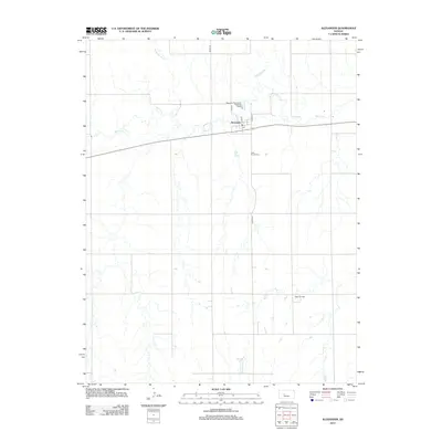
2012 Map of Alexander
USGS Topo · Published 2012About this map
Walnut Creek and its tributary Alexander Dry Creek carve a slow, winding path through the agricultural landscape of Rush County. The settlement of Alexander sits at a crossroads, centered around its local Post Office and basic infrastructure like the Alexander Wastewater Treatment Facility. This map shows the quiet grid of rural Kansas in the early 21st century, where the land is divided between active cultivation and localized industrial activity at the Webs Oil Field. To the south of the village, the Belle Prairie Cemetery serves as a silent landmark for local genealogy, marking the generations that have worked this prairie soil. The road network, including County Highway 524 and Main Street, illustrates the enduring structure of this small High Plains community.
Find a feature on this map
12 named features on this map. Tap any name to fly to it.
Don’t see what you’re looking for? This feature index may not catch every label — zoom into the map to look around manually.
Map Details
Editions of this 2012 Alexander Map
This is the sole edition of this map. No revisions or reprints were ever made.
Other maps of this area

1889 · Larned
USGS Topo · 1:125,000

1891 · Larned
USGS Topo · 1:125,000

1892 · Ness
USGS Topo · 1:125,000

1893 · Ellis
USGS Topo · 1:125,000

1894 · Ness
USGS Topo · 1:125,000

1896 · Hays
USGS Topo · 1:125,000

1955 · Great Bend
USGS Topo · 1:250,000

1957 · Great Bend
USGS Topo · 1:250,000

1958 · Great Bend
USGS Topo · 1:250,000

1965 · Mc Cracken
USGS Topo · 1:24,000