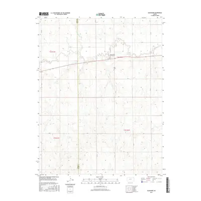
2015 Map of Alexander
USGS Topo · Published 2015About this map
The small settlement of Alexander anchors this high-plains landscape where the central Kansas prairies meet the drainages of the Walnut Cr and Alexander Dry Cr. This 2015 survey reveals the agrarian layout of the region, defined by a rigid section-line road network and the political boundary of Ness Co Rush Co. Local heritage is centered around the Belle Prairie Cem and the proximity to Highway 96, which parallels the creek as it moves through the terrain. The map depicts a late-modern view of these rural townships, where the primary infrastructure remains focused on agricultural transport and the preservation of historic sites like the local cemetery.
Find a feature on this map
25 named features on this map. Tap any name to fly to it.
Don’t see what you’re looking for? This feature index may not catch every label — zoom into the map to look around manually.
Map Details
Editions of this 2015 Alexander Map
This is the sole edition of this map. No revisions or reprints were ever made.
Other maps of this area

1889 · Larned
USGS Topo · 1:125,000

1891 · Larned
USGS Topo · 1:125,000

1892 · Ness
USGS Topo · 1:125,000

1893 · Ellis
USGS Topo · 1:125,000

1894 · Ness
USGS Topo · 1:125,000

1896 · Hays
USGS Topo · 1:125,000

1955 · Great Bend
USGS Topo · 1:250,000

1957 · Great Bend
USGS Topo · 1:250,000

1958 · Great Bend
USGS Topo · 1:250,000

1965 · Mc Cracken
USGS Topo · 1:24,000