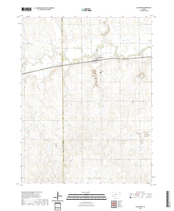
2022 Map of Alexander
USGS Topo · Published 2022About this map
Alexander sits at the intersection of local history and the West Central Kansas plains, positioned where the Ness Co Rush Co boundary meets the winding course of Walnut Cr. This 2022 survey captures the small-town layout of the village, noting its central thoroughfares of Main St and King St just north of the highway. The landscape beyond the settlement is defined by agricultural section lines and the intermittent drainage of Alexander Dry Cr, reflecting the region's dependence on its occasional watercourses. To the south of the town center, the Belle Prairie Cem serves as a significant landmark for genealogists and local historians, anchoring the surrounding rural sections. The map reveals a highly structured grid of county roads, such as CR 110 and Ave S, which organize the expansive terrain into distinct townships and ranges.
Find a feature on this map
26 named features on this map. Tap any name to fly to it.
Don’t see what you’re looking for? This feature index may not catch every label — zoom into the map to look around manually.
Map Details
Editions of this 2022 Alexander Map
This is the sole edition of this map. No revisions or reprints were ever made.
Other maps of this area

1889 · Larned
USGS Topo · 1:125,000

1891 · Larned
USGS Topo · 1:125,000

1892 · Ness
USGS Topo · 1:125,000

1893 · Ellis
USGS Topo · 1:125,000

1894 · Ness
USGS Topo · 1:125,000

1896 · Hays
USGS Topo · 1:125,000

1955 · Great Bend
USGS Topo · 1:250,000

1957 · Great Bend
USGS Topo · 1:250,000

1958 · Great Bend
USGS Topo · 1:250,000

1965 · Mc Cracken
USGS Topo · 1:24,000