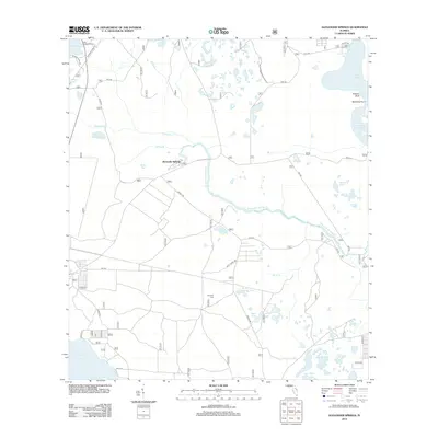
2012 Map of Alexander Springs
USGS Topo · Published 2012About this map
Alexander Springs lies at the heart of this landscape, where the namesake Alexander Springs Cr flows through the lowlands of Billies Bay. This 2012 survey illustrates a region defined by its hydrography, from the expansive Lake Dexter in the northeast to Lake Dorr in the southwest. A network of Forest Service roads, such as NFS 538-2 and NFS 544, provides access to numerous isolated water bodies like Dillard Pond, Mud Pond, and Bunch Ground Pond.
Find a feature on this map
47 named features on this map. Tap any name to fly to it.
Don’t see what you’re looking for? This feature index may not catch every label — zoom into the map to look around manually.
Map Details
Editions of this 2012 Alexander Springs Map
This is the sole edition of this map. No revisions or reprints were ever made.
Other maps of this area

1954 · Daytona Beach
USGS Topo · 1:250,000

1955 · Orlando
USGS Topo · 1:250,000

1957 · Orlando
USGS Topo · 1:250,000

1958 · Orlando
USGS Topo · 1:250,000

1958 · Daytona Beach
USGS Topo · 1:250,000

1962 · Orlando
USGS Topo · 1:250,000

1962 · Pine Lakes
USGS Topo · 1:24,000

1962 · Lake Woodruff
USGS Topo · 1:24,000

1964 · Daytona Beach
USGS Topo · 1:250,000

1965 · Umatilla
USGS Topo · 1:24,000