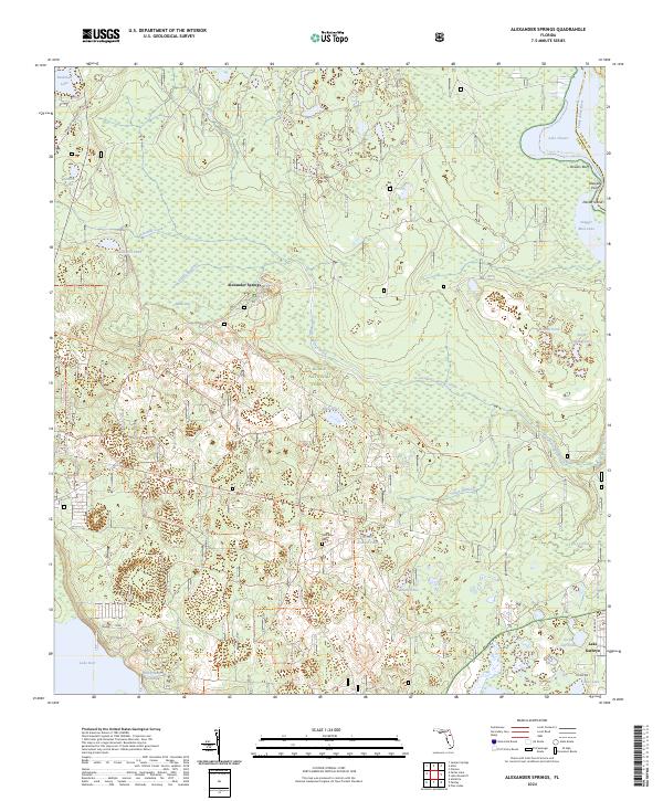
2024 Map of Alexander Springs
USGS Topo · Published 2024About this map
Alexander Springs serves as the focal point of this hydrologically complex landscape within the Ocala National Forest. The map documents a territory defined by the transition from upland forest to the expansive wetlands of the Saint Johns River basin, which forms the eastern boundary near Bowers Bluff. Evidence of early 20th-century industry persists in the form of Railroad Grade Rd, while the secluded Shockley Cem offers a primary point of interest for those researching local family history.
Find a feature on this map
53 named features on this map. Tap any name to fly to it.
Don’t see what you’re looking for? This feature index may not catch every label — zoom into the map to look around manually.
Map Details
Editions of this 2024 Alexander Springs Map
This is the sole edition of this map. No revisions or reprints were ever made.
Other maps of this area

1954 · Daytona Beach
USGS Topo · 1:250,000

1955 · Orlando
USGS Topo · 1:250,000

1957 · Orlando
USGS Topo · 1:250,000

1958 · Orlando
USGS Topo · 1:250,000

1958 · Daytona Beach
USGS Topo · 1:250,000

1962 · Orlando
USGS Topo · 1:250,000

1962 · Pine Lakes
USGS Topo · 1:24,000

1962 · Lake Woodruff
USGS Topo · 1:24,000

1964 · Daytona Beach
USGS Topo · 1:250,000

1965 · Umatilla
USGS Topo · 1:24,000