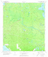
1972 Map of Alexander Springs
USGS Topo · Published 1973About this map
Alexander Springs Creek winds through the heart of the Ocala National Forest, defining a landscape of wetlands and hydrologic complexity in eastern Lake County. This early 1970s survey captures the region just before significant modern development, focusing on the intricate network of basins including Billies Bay and Billies Bay Branch. Along the northeastern edge, the St Johns River serves as the county line, widening into Lake Dexter near Bowers Bluff and Idlewild Pt.
Find a feature on this map
31 named features on this map. Tap any name to fly to it.
Don’t see what you’re looking for? This feature index may not catch every label — zoom into the map to look around manually.
Map Details
Editions of this 1972 Alexander Springs Map
This is the sole edition of this map. No revisions or reprints were ever made.
Other maps of this area

1954 · Daytona Beach
USGS Topo · 1:250,000

1955 · Orlando
USGS Topo · 1:250,000

1957 · Orlando
USGS Topo · 1:250,000

1958 · Orlando
USGS Topo · 1:250,000

1958 · Daytona Beach
USGS Topo · 1:250,000

1962 · Orlando
USGS Topo · 1:250,000

1962 · Pine Lakes
USGS Topo · 1:24,000

1962 · Lake Woodruff
USGS Topo · 1:24,000

1964 · Daytona Beach
USGS Topo · 1:250,000

1965 · Umatilla
USGS Topo · 1:24,000