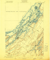
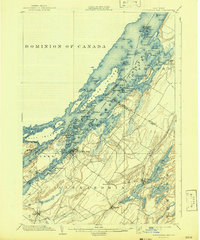
1903 Map of Alexandria Bay
USGS Topo · Published 1918About this map
The St. Lawrence River serves as a sprawling international boundary in this 1903 study, defined by the Dominion of Canada United States line weaving through a dense archipelago. Alexandria Bay stands as the primary hub on the New York shore, surrounded by a landscape of private parks and summer resorts like Westminster Park and Point Vivian. The map captures the era of the great river estates and the Steamboat Company Line, reflecting a region built on maritime commerce and seasonal tourism.
Find a feature on this map
123 named features on this map. Tap any name to fly to it.
Don’t see what you’re looking for? This feature index may not catch every label — zoom into the map to look around manually.
Map Details
Editions of this 1903 Alexandria Bay Map
6 editions found
Other maps of this area

1900 · Clayton
USGS Topo · 1:62,500

1903 · Grindstone
USGS Topo · 1:62,500

1903 · Clayton
USGS Topo · 1:62,500

1903 · Alexandria Bay
USGS Topo · 1:62,500

1903 · Theresa
USGS Topo · 1:62,500

1906 · Brier Hill
USGS Topo · 1:62,500

1911 · Antwerp
USGS Topo · 1:62,500

1912 · Hammond
USGS Topo · 1:62,500

1942 · Clayton
USGS Topo · 1:24,000

1942 · Morristown
USGS Topo · 1:24,000