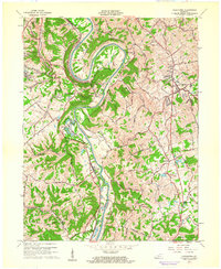
1961 Map of Alexandria
USGS Topo · Published 1962About this map
The Licking River carves a dramatic oxbow at Grants Bend, defining the border between Kenton and Campbell Counties. This early 1960s survey illustrates a landscape of ridge-top settlements and deep wooded hollows, where the Louisville and Nashville railroad tracks parallel the river's winding course. To the west, small residential pockets like Latonia Lakes and Ryland Heights appear, while Alexandria serves as a primary inland hub on the eastern side of the sheet.
Find a feature on this map
45 named features on this map. Tap any name to fly to it.
Don’t see what you’re looking for? This feature index may not catch every label — zoom into the map to look around manually.
Map Details
Editions of this 1961 Alexandria Map
2 editions found
Other maps of this area

1898 · East Cincinnati
USGS Topo · 1:62,500

1914 · East Cincinnati
USGS Topo · 1:62,500

1914 · West Cincinnati
USGS Topo · 1:62,500

1929 · Alexandria
USGS Topo · 1:48,000

1936 · Alexandria
USGS Topo · 1:62,500

1950 · Independence
USGS Topo · 1:24,000

1950 · Walton
USGS Topo · 1:24,000

1950 · Covington
USGS Topo · 1:24,000

1952 · Newport
USGS Topo · 1:24,000

1953 · Withamsville
USGS Topo · 1:24,000