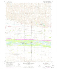
1962 Map of Alfalfa Center
USGS Topo · Published 1977About this map
The Platte River braided channel dominates this central Nebraska landscape, defining the boundaries between Buffalo, Phelps, and Kearney counties. The small settlement of Alfalfa Center serves as a local focal point near the Union Pacific rail line and the parallel Kearney Canal. This 1962 survey, updated with 1974 photogrammetric revisions, documents the intricate irrigation and drainage network of the region, featuring Whisky Slough and the Turkey Creek North Channel.
Find a feature on this map
29 named features on this map. Tap any name to fly to it.
Don’t see what you’re looking for? This feature index may not catch every label — zoom into the map to look around manually.
Map Details
Editions of this 1962 Alfalfa Center Map
2 editions found
Other maps of this area

1894 · Kearney
USGS Topo · 1:62,500

1896 · Kearney
USGS Topo · 1:125,000

1955 · Grand Island
USGS Topo · 1:250,000

1957 · Grand Island
USGS Topo · 1:250,000

1958 · Grand Island
USGS Topo · 1:250,000

1961 · Amherst
USGS Topo · 1:24,000

1962 · Riverdale
USGS Topo · 1:24,000

1962 · Elm Creek East
USGS Topo · 1:24,000
1962 · Pleasanton SE
USGS Topo · 1:24,000
1962 · Kearney
USGS Topo · 1:24,000
Featured Places
- Kearney, NE
- Sheens Trailer Court, NE
- Alfalfa Center, NE
- Cottonmill Mobile Home Court, NE
- Buffalo County, NE