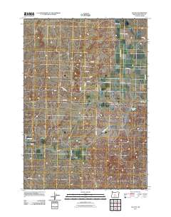
2011 Map of Alfalfa
USGS Topo · Published 2011About this map
Alfalfa serves as the focal point for this high-desert community in Deschutes County, where the settlement's layout is defined by a network of ranch roads and irrigation infrastructure. The path of the Central Oregon Canal winds through the southern terrain, an essential water source for the surrounding agricultural properties. To the east, the Dry River bed and natural depressions such as Zell Pond and Reynolds Pond suggest the arid character of the landscape. Aviation history is represented by Juniper Air Park, located near the intersection of Dodds RD and Cougar TRL. Named thoroughfares like Johnson Ranch Rd, Diamond Forge Rd, and Alfalfa Market Rd highlight the ranching heritage and rural connectivity of the region. Local explorers can trace the precise boundaries of individual land parcels and the winding routes of local lanes like Bachelor Ln and Cultus LN.
Find a feature on this map
28 named features on this map. Tap any name to fly to it.
Don’t see what you’re looking for? This feature index may not catch every label — zoom into the map to look around manually.
Map Details
Editions of this 2011 Alfalfa Map
This is the sole edition of this map. No revisions or reprints were ever made.
Other maps of this area

1926 · Bend
USGS Topo · 1:125,000

1929 · Bend
USGS Topo · 1:125,000

1931 · Newberry Crater
USGS Topo · 1:125,000

1935 · Newberry Crater
USGS Topo · 1:125,000

1955 · Crescent
USGS Topo · 1:250,000

1955 · Bend
USGS Topo · 1:250,000

1957 · Crescent
USGS Topo · 1:250,000

1957 · Bend
USGS Topo · 1:250,000

1958 · Crescent
USGS Topo · 1:250,000

1958 · Bend
USGS Topo · 1:250,000