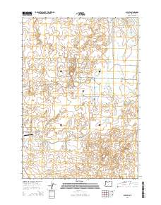
2014 Map of Alfalfa
USGS Topo · Published 2014About this map
The settlement of Alfalfa serves as the focal point for this 2014 survey of central Oregon high desert ranch land. The landscape is defined by the vital movement of water and aviation, most notably via the Central Oregon Canal and the presence of Juniper Air Park in the southwest. Historical land use and property lines are reflected in the grid of local thoroughfares such as Alfalfa Market Rd and Johnson Ranch Rd, which connect the scattered homesteads across this arid plateau. To the northeast, the ancient path of the Dry River cuts through the terrain near Reynolds Pond, illustrating the hydraulic history of Deschutes County. The map provides a detailed view of local infrastructure, from the small airfield's runway on Skywagon Dr to the winding course of the Central Oregon Canal as it supports agriculture in this high-elevation environment.
Find a feature on this map
33 named features on this map. Tap any name to fly to it.
Don’t see what you’re looking for? This feature index may not catch every label — zoom into the map to look around manually.
Map Details
Editions of this 2014 Alfalfa Map
This is the sole edition of this map. No revisions or reprints were ever made.
Other maps of this area

1926 · Bend
USGS Topo · 1:125,000

1929 · Bend
USGS Topo · 1:125,000

1931 · Newberry Crater
USGS Topo · 1:125,000

1935 · Newberry Crater
USGS Topo · 1:125,000

1955 · Crescent
USGS Topo · 1:250,000

1955 · Bend
USGS Topo · 1:250,000

1957 · Crescent
USGS Topo · 1:250,000

1957 · Bend
USGS Topo · 1:250,000

1958 · Crescent
USGS Topo · 1:250,000

1958 · Bend
USGS Topo · 1:250,000