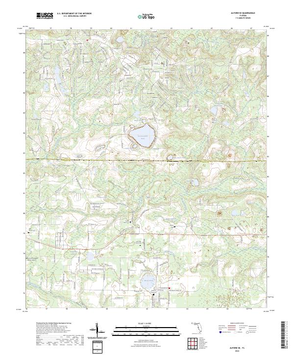
2024 Map of Alford SE
USGS Topo · Published 2024About this map
Seventeenmile Pond and Mossy Pond dot this Florida landscape, where the boundary between Jackson Co and Calhoun Co divides a region defined by its numerous water bodies and family-named landmarks. The terrain transitions between wetland basins and higher ground such as Carmichael Head and Briar Head. The path of the Florida National Scenic Trl winds through the central portion of the sheet, providing a modern point of reference for researchers tracing the geography of the Panhandle interior.
Find a feature on this map
202 named features on this map. Tap any name to fly to it.
Don’t see what you’re looking for? This feature index may not catch every label — zoom into the map to look around manually.
Map Details
Editions of this 2024 Alford SE Map
This is the sole edition of this map. No revisions or reprints were ever made.
Other maps of this area

1944 · Clarksville
USGS Topo · 1:31,680

1945 · Juniper Creek
USGS Topo · 1:31,680

1945 · Clarksville
USGS Topo · 1:31,680

1945 · Fountain
USGS Topo · 1:31,680

1952 · Oakdale
USGS Topo · 1:24,000

1952 · Kynesville
USGS Topo · 1:24,000

1952 · Alford SE
USGS Topo · 1:24,000

1952 · Altha West
USGS Topo · 1:24,000
1952 · Compass Lake
USGS Topo · 1:24,000
1952 · Alford
USGS Topo · 1:24,000