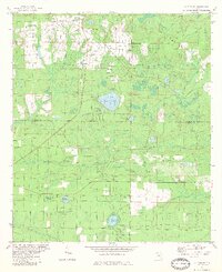
1982 Map of Alford SE
USGS Topo · Published 1983About this map
Compass Lake Hills is a prominent residential development in the northern portion of this Jackson and Calhoun County landscape, marked by a dense grid of curvilinear roads that contrast with the more traditional rural layout to the south. The terrain is characterized by a high concentration of karst-like sinkhole ponds and drainage basins, including the expansive Seventeenmile Pond, Porter Pond, and the secluded Mossy Pond. Small rural communities such as Melvin and Flanders center around crossroads and local landmarks like Pippin and Briar Head. Local history is anchored by the Camps Head Ch and the Pippin Cem, reflecting the early settlement patterns of this Florida Panhandle region. The landscape is also defined by its watercourses, with Econfina Creek and Tenmile Creek cutting through the vegetation-dense lowlands, while industrial activity is indicated by a Claypit near the central section.
Find a feature on this map
33 named features on this map. Tap any name to fly to it.
Don’t see what you’re looking for? This feature index may not catch every label — zoom into the map to look around manually.
Map Details
Editions of this 1982 Alford SE Map
This is the sole edition of this map. No revisions or reprints were ever made.
Other maps of this area

1944 · Clarksville
USGS Topo · 1:31,680

1945 · Juniper Creek
USGS Topo · 1:31,680

1945 · Clarksville
USGS Topo · 1:31,680

1945 · Fountain
USGS Topo · 1:31,680

1952 · Oakdale
USGS Topo · 1:24,000

1952 · Kynesville
USGS Topo · 1:24,000

1952 · Alford SE
USGS Topo · 1:24,000

1952 · Altha West
USGS Topo · 1:24,000
1952 · Compass Lake
USGS Topo · 1:24,000
1952 · Alford
USGS Topo · 1:24,000