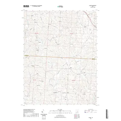
2019 Map of Alfred
USGS Topo · Published 2019About this map
Coolville Ridge and Bearwallow Ridge anchor the high ground in this section of the southeastern Ohio hill country, where the borders of Athens and Meigs counties meet. The landscape is defined by the winding paths of the East Branch Shade River and Middle Branch Shade River, which have carved numerous hollows such as Dog Hollow and Palk Hollow. Small crossroads and rural centers like Alfred, Sumner, and Lottridge are connected by a network of township roads and county highways that follow the ridgelines and valley floors.
Find a feature on this map
148 named features on this map. Tap any name to fly to it.
Don’t see what you’re looking for? This feature index may not catch every label — zoom into the map to look around manually.
Map Details
Editions of this 2019 Alfred Map
This is the sole edition of this map. No revisions or reprints were ever made.
Other maps of this area

1903 · Athens
USGS Topo · 1:62,500

1904 · Chesterhill
USGS Topo · 1:62,500

1905 · Athens
USGS Topo · 1:62,500

1906 · Chesterhill
USGS Topo · 1:62,500

1907 · Pomeroy
USGS Topo · 1:62,500

1907 · Keno
USGS Topo · 1:62,500

1947 · Columbus
USGS Topo · 1:250,000

1949 · Clarksburg
USGS Topo · 1:250,000

1956 · Clarksburg
USGS Topo · 1:250,000
1960 · Alfred
USGS Topo · 1:24,000