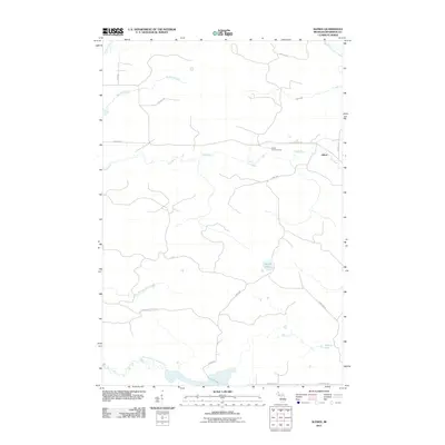
2011 Map of Alfred
USGS Topo · Published 2011About this map
Alfred serves as the primary point of settlement in this northern Dickinson County landscape, situated where the Ford River meets the local road network. The area is defined by a dense drainage system, with the North Branch Ford River and Stafford Creek carving through the terrain. Evidence of regional management and observation is clear at the Alfred Lookout Tower, which provides a vantage point over the timbered tracts of West Branch Township. The map captures a transition in water systems, where the East Branch Skunk Creek and the East Branch Sturgeon River flow toward the southern boundary. This 2011 survey documents a remote interior of Michigan's Upper Peninsula, illustrating the intersection of natural waterways like Marsh Lake and Peronto Lake with a network of resource-access routes, including Pipeline Rd and Camp 3 Rd, reflecting the region's long-standing connection to the timber and utilities industries.
Find a feature on this map
22 named features on this map. Tap any name to fly to it.
Don’t see what you’re looking for? This feature index may not catch every label — zoom into the map to look around manually.
Map Details
Editions of this 2011 Alfred Map
This is the sole edition of this map. No revisions or reprints were ever made.
Other maps of this area

1954 · Escanaba
USGS Topo · 1:250,000

1955 · Ralph NE
USGS Topo · 1:24,000

1955 · Norway
USGS Topo · 1:62,500

1955 · Ralph
USGS Topo · 1:62,500

1956 · Foster City
USGS Topo · 1:62,500

1957 · Escanaba
USGS Topo · 1:250,000

1957 · Northland
USGS Topo · 1:62,500

1958 · Escanaba
USGS Topo · 1:250,000

1958 · Marquette
USGS Topo · 1:250,000

1960 · Marquette
USGS Topo · 1:250,000