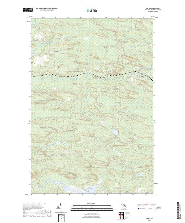
2023 Map of Alfred
USGS Topo · Published 2023About this map
The settlement of Alfred stands as the primary namesake community within this Dickinson County landscape, situated where the North Branch Ford River and the main Ford River converge. This modern survey illustrates a region defined by its hydrography and logging-era road network, featuring numerous wetlands and water bodies like Peronto Lake and Marsh Lake. The southern portion of the quadrangle is dominated by the Hardwood Impoundment along the East Branch Sturgeon River, a significant hydrological feature that influences the local drainage patterns. Transportation is facilitated by a grid of named routes such as Co Rd 426 and the Norway Lake Truck Trl, which provide access to the interior. The map also traces various tributaries including Bear Creek, Stafford Creek, and East Branch Skunk Creek, providing a detailed view of the watershed as it appeared in the early 21st century.
Find a feature on this map
29 named features on this map. Tap any name to fly to it.
Don’t see what you’re looking for? This feature index may not catch every label — zoom into the map to look around manually.
Map Details
Editions of this 2023 Alfred Map
This is the sole edition of this map. No revisions or reprints were ever made.
Other maps of this area

1954 · Escanaba
USGS Topo · 1:250,000

1955 · Ralph NE
USGS Topo · 1:24,000

1955 · Norway
USGS Topo · 1:62,500

1955 · Ralph
USGS Topo · 1:62,500

1956 · Foster City
USGS Topo · 1:62,500

1957 · Escanaba
USGS Topo · 1:250,000

1957 · Northland
USGS Topo · 1:62,500

1958 · Escanaba
USGS Topo · 1:250,000

1958 · Marquette
USGS Topo · 1:250,000

1960 · Marquette
USGS Topo · 1:250,000