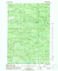
1986 Map of Alfred
USGS Topo · Published 1986About this map
Copper Country State Forest dominates this landscape in Dickinson County, where the topography is defined by an intricate network of waterways. The small settlement of Alfred is situated in the northeastern corner of the map, positioned near the confluence of the Ford River and the North Branch Ford River. The area is characterized by low-lying wetlands and numerous tributary streams, including Coffee Creek, Skunk Creek, and Bear Creek, which feed into the larger river systems.
Find a feature on this map
20 named features on this map. Tap any name to fly to it.
Don’t see what you’re looking for? This feature index may not catch every label — zoom into the map to look around manually.
Map Details
Editions of this 1986 Alfred Map
This is the sole edition of this map. No revisions or reprints were ever made.
Other maps of this area

1954 · Escanaba
USGS Topo · 1:250,000

1955 · Ralph NE
USGS Topo · 1:24,000

1955 · Norway
USGS Topo · 1:62,500

1955 · Ralph
USGS Topo · 1:62,500

1956 · Foster City
USGS Topo · 1:62,500

1957 · Escanaba
USGS Topo · 1:250,000

1957 · Northland
USGS Topo · 1:62,500

1958 · Escanaba
USGS Topo · 1:250,000

1958 · Marquette
USGS Topo · 1:250,000

1960 · Marquette
USGS Topo · 1:250,000