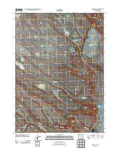
2011 Map of Alger Lake
USGS Topo · Published 2011About this map
Alger Lake and its surrounding high-desert basin define this remote section of Lake County as it appeared in 2011. The landscape is marked by a network of seasonal water bodies and catchment points essential for land management and ranching, such as the Hitching Post Water Hole and Coffee Pot Reservoir. The presence of named features like Billy Burr Lake, Fred Pond, and Nora Pond suggest a history of local land use and family-named landmarks in an otherwise sparsely populated region. Guano Creek meanders through the southern half of the quadrangle, passing through Clover Swale before crossing Bureau of Land Mgmt Road 6186. This map provides a detailed view of the drainage patterns and ephemeral water sources, from the Thunderbird Lake in the northwest to the North Lakes on the eastern edge, which are critical for understanding the hydrology of the Oregon desert.
Find a feature on this map
17 named features on this map. Tap any name to fly to it.
Don’t see what you’re looking for? This feature index may not catch every label — zoom into the map to look around manually.
Map Details
Editions of this 2011 Alger Lake Map
This is the sole edition of this map. No revisions or reprints were ever made.
Other maps of this area

1955 · Adel
USGS Topo · 1:250,000

1957 · Adel
USGS Topo · 1:250,000

1958 · Adel
USGS Topo · 1:250,000

1962 · Adel
USGS Topo · 1:250,000

1967 · Jacobs Reservoir
USGS Topo · 1:24,000

1967 · Alger Lake
USGS Topo · 1:24,000

1967 · Warner Peak
USGS Topo · 1:24,000

1967 · Swede Knoll
USGS Topo · 1:24,000

1968 · Guano Lake
USGS Topo · 1:24,000
1968 · Mud Lake Reservoir
USGS Topo · 1:24,000