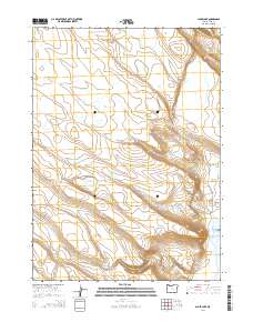
2014 Map of Alger Lake
USGS Topo · Published 2014About this map
Alger Lake and its surrounding desert basin define this high-desert landscape in Lake County, Oregon. This region is characterized by a network of seasonal water bodies and terminal basins, including the clusters of Cat Lakes, Dobyns Lake, and Desert Lake. The topography reveals the intricate drainage patterns of the Guano Valley, where ephemeral streams and depressions such as Clover Swale and Fred Pond collect runoff.
Find a feature on this map
21 named features on this map. Tap any name to fly to it.
Don’t see what you’re looking for? This feature index may not catch every label — zoom into the map to look around manually.
Map Details
Editions of this 2014 Alger Lake Map
This is the sole edition of this map. No revisions or reprints were ever made.
Other maps of this area

1955 · Adel
USGS Topo · 1:250,000

1957 · Adel
USGS Topo · 1:250,000

1958 · Adel
USGS Topo · 1:250,000

1962 · Adel
USGS Topo · 1:250,000

1967 · Jacobs Reservoir
USGS Topo · 1:24,000

1967 · Alger Lake
USGS Topo · 1:24,000

1967 · Warner Peak
USGS Topo · 1:24,000

1967 · Swede Knoll
USGS Topo · 1:24,000

1968 · Guano Lake
USGS Topo · 1:24,000
1968 · Mud Lake Reservoir
USGS Topo · 1:24,000