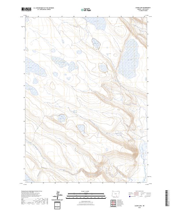
2024 Map of Alger Lake
USGS Topo · Published 2024About this map
Hart Mountain-National Antelope Refuge protects this high-desert basin in Lake County, where seasonal water sources define the survival of the landscape. The hydrography is dominated by ephemeral lakes and man-made improvements, such as the Coffee Pot Reservoir and Hitching Post Water Hole, which provide critical water in an otherwise arid environment. Large basins like Alger Lake, Dobyns Lake, and Desert Lake anchor the northern half of the region, while the southern terrain is carved by the Guano Valley and the winding course of Guano Creek. Surface travel is limited to remote Bureau of Land Management routes, including BLM RD 6106-0-00, which traverses the Clover Swale. This survey illustrates the specialized infrastructure of western rangeland, where isolated ponds and reservoirs serve as the primary landmarks in a territory managed for wildlife and conservation.
Find a feature on this map
21 named features on this map. Tap any name to fly to it.
Don’t see what you’re looking for? This feature index may not catch every label — zoom into the map to look around manually.
Map Details
Editions of this 2024 Alger Lake Map
This is the sole edition of this map. No revisions or reprints were ever made.
Other maps of this area

1955 · Adel
USGS Topo · 1:250,000

1957 · Adel
USGS Topo · 1:250,000

1958 · Adel
USGS Topo · 1:250,000

1962 · Adel
USGS Topo · 1:250,000

1967 · Jacobs Reservoir
USGS Topo · 1:24,000

1967 · Alger Lake
USGS Topo · 1:24,000

1967 · Warner Peak
USGS Topo · 1:24,000

1967 · Swede Knoll
USGS Topo · 1:24,000

1968 · Guano Lake
USGS Topo · 1:24,000
1968 · Mud Lake Reservoir
USGS Topo · 1:24,000