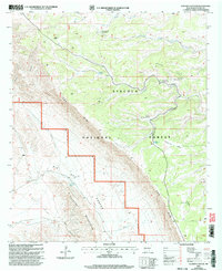
2001 Map of Algerita Canyon
USGS Topo · Published 2003About this map
Lincoln National Forest land dominates this high-altitude landscape in southern New Mexico, where the dramatic escarpment of The Rim separates the upper plateaus from the lower desert basins. The map illustrates a specialized system of water management essential for livestock and forestry in this arid environment, evidenced by named facilities such as Coon Dog Well Storage Tank, Patterson Water Storage Tank, and the Algerita Tank. To the west, the terrain drops steeply into the expanse of Big Dog Canyon and toward the Salt Flat, while the southern portion of the sheet is defined by the rugged Brokeoff Mountains. This 2001 revision highlights the intersection of natural topography and utility, showing the network of light-duty and unimproved roads that navigate features like Powers Ridge and Algerita Canyon.
Find a feature on this map
25 named features on this map. Tap any name to fly to it.
Don’t see what you’re looking for? This feature index may not catch every label — zoom into the map to look around manually.
Map Details
Editions of this 2001 Algerita Canyon Map
This is the sole edition of this map. No revisions or reprints were ever made.
Other maps of this area

1935 · El Paso Gap
USGS Topo · 1:62,500

1936 · El Paso Gap
USGS Topo · 1:48,000

1940 · El Paso Gap
USGS Topo · 1:62,500

1943 · Texas Hill
USGS Topo · 1:62,500

1945 · Texas Hill
USGS Topo · 1:62,500

1954 · Carlsbad
USGS Topo · 1:250,000

1958 · Carlsbad
USGS Topo · 1:250,000

1963 · Gowdy Ranch
USGS Topo · 1:24,000

1963 · Panama Ranch
USGS Topo · 1:24,000
1969 · Sheep Draw
USGS Topo · 1:24,000