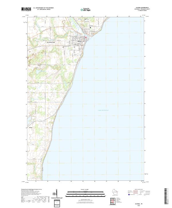
2022 Map of Algoma
USGS Topo · Published 2022About this map
Algoma sits at the meeting point of the Ahnapee River and the vast waters of Lake Michigan, serving as the primary hub for this stretch of the Wisconsin shoreline. The landscape transitions from the developed grid of the town center to the outlying agricultural areas and smaller clusters of settlement. To the west, the community of Bruemmerville is situated along the river's upper reaches, while the small hamlet of Alaska marks the southern approach along the coast. The legacy of local families is preserved across the landscape in sites like Wiesner Cem and Evergreen Cem.
Find a feature on this map
60 named features on this map. Tap any name to fly to it.
Don’t see what you’re looking for? This feature index may not catch every label — zoom into the map to look around manually.
Map Details
Editions of this 2022 Algoma Map
This is the sole edition of this map. No revisions or reprints were ever made.
Other maps of this area

1952 · Casco
USGS Topo · 1:62,500

1954 · Kewaunee
USGS Topo · 1:62,500

1954 · Manitowoc
USGS Topo · 1:250,000

1958 · Manitowoc
USGS Topo · 1:250,000

1960 · Algoma
USGS Topo · 1:62,500

1978 · Casco
USGS Topo · 1:24,000

1978 · Brussels
USGS Topo · 1:24,000
1978 · Kewaunee
USGS Topo · 1:24,000
1982 · Algoma
USGS Topo · 1:24,000
1982 · Algoma NE
USGS Topo · 1:24,000