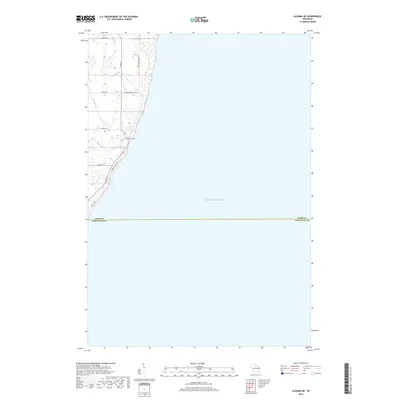
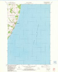
2018 Map of Algoma NE
USGS Topo · Published 2018About this map
Lake Michigan dominates this coastal survey, where the shoreline of Door County meets Kewaunee County. The landscape is defined by a series of small waterways, including Woodard Cr, Schuyler Cr, and Bear Cr, which cut through the lakeside bluffs toward the water. Human activity is concentrated along a network of rural roads that hug the coast or lead into the interior, such as S Lake Michigan Dr and Lower Lasalle Rd. A significant point of interest for genealogists and local historians is the Claybanks Cem, situated near the shoreline between Midway Rd and Mount Lookout Rd. This 2018 edition provides a clear picture of the contemporary coastal land use and road patterns before the terrain drops off into the deep waters of the lake.
Find a feature on this map
15 named features on this map. Tap any name to fly to it.
Don’t see what you’re looking for? This feature index may not catch every label — zoom into the map to look around manually.
Map Details
Editions of this 2018 Algoma NE Map
This is the sole edition of this map. No revisions or reprints were ever made.
Other maps of this area

1954 · Manitowoc
USGS Topo · 1:250,000

1958 · Manitowoc
USGS Topo · 1:250,000

1960 · Sturgeon Bay
USGS Topo · 1:62,500

1960 · Jacksonport
USGS Topo · 1:62,500

1960 · Algoma
USGS Topo · 1:62,500

1981 · Sturgeon Bay West
USGS Topo · 1:24,000
1981 · Sturgeon Bay East
USGS Topo · 1:24,000
1982 · Algoma
USGS Topo · 1:24,000
1982 · Jacksonport SW
USGS Topo · 1:24,000
1982 · Algoma NE
USGS Topo · 1:24,000