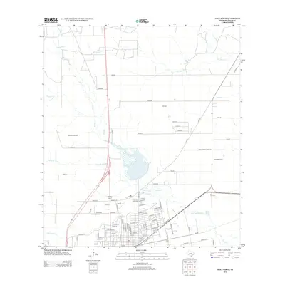
2013 Map of Alice North
USGS Topo · Published 2013About this map
Hydrological patterns and energy infrastructure define this part of the Brush Country north of the city limits. The landscape is carved by several winding seasonal drainages, including Chiltipin Cr, Palo Hueco Cr, and San Diego Cr, which feed into the larger Resaca de Enmedio. These watercourses stand in contrast to the rigid grid of county roads and petroleum developments that mark the region's economic history. Industrial activity is prominent through the Alice North Oil Field, Embleton Oil Field, and Bentonville Oil Field, showing the extensive reach of the oil and gas industry into the rural surroundings. Towards the southern edge, the map transitions into residential street layouts, with Rose Lawn Cem and Collins Cem serving as significant local landmarks for genealogical research. The intersection of Farm-To-Market Road 3376 and other regional routes illustrates the modern transportation network connecting these resource-rich lands.
Find a feature on this map
80 named features on this map. Tap any name to fly to it.
Don’t see what you’re looking for? This feature index may not catch every label — zoom into the map to look around manually.
Map Details
Editions of this 2013 Alice North Map
This is the sole edition of this map. No revisions or reprints were ever made.
Other maps of this area

1917 · Ben Bolt
USGS Topo · 1:62,500

1920 · San Diego
USGS Topo · 1:62,500

1950 · Corpus Christi
USGS Topo · 1:250,000

1954 · Orange Grove
USGS Topo · 1:62,500

1954 · Kingsville
USGS Topo · 1:62,500

1956 · Corpus Christi
USGS Topo · 1:250,000

1956 · Laredo
USGS Topo · 1:250,000

1960 · Corpus Christi
USGS Topo · 1:250,000

1963 · San Diego NE
USGS Topo · 1:24,000

1963 · San Diego
USGS Topo · 1:24,000
Featured Places
- Alice, TX
- Hollow Tree Estates Colonia, TX
- Kiesling's Colonia, Alice
- Del Norte Mobile Home Park Colonia, TX
- Howell Addition Colonia, TX