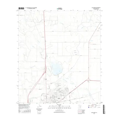
2016 Map of Alice North
USGS Topo · Published 2016About this map
The South Texas city of Alice serves as the focal point for this survey of the South Texas plains, where the convergence of several major drainages defines the local geography. The landscape is marked by a complex network of seasonal creeks and waterways, including the winding Palo Hueco Cr and Chiltipin Cr, which feeds into Lake Alice north of the city center. This area reflects a long history of ranching and transportation, with the modern corridors of 281 and 359 crossing over ancient streambeds like the Resaca de Enmedio and Muerto Cr. For genealogists, the map identifies local burial grounds such as Rose Lawn Cem to the east and Collins Cem to the south. The layout of the street grid in Alice and the surrounding county road system reveals the structured growth of Jim Wells County around these vital water sources, including the San Diego Cr and San Fernando Cr.
Find a feature on this map
97 named features on this map. Tap any name to fly to it.
Don’t see what you’re looking for? This feature index may not catch every label — zoom into the map to look around manually.
Map Details
Editions of this 2016 Alice North Map
This is the sole edition of this map. No revisions or reprints were ever made.
Other maps of this area

1917 · Ben Bolt
USGS Topo · 1:62,500

1920 · San Diego
USGS Topo · 1:62,500

1950 · Corpus Christi
USGS Topo · 1:250,000

1954 · Orange Grove
USGS Topo · 1:62,500

1954 · Kingsville
USGS Topo · 1:62,500

1956 · Corpus Christi
USGS Topo · 1:250,000

1956 · Laredo
USGS Topo · 1:250,000

1960 · Corpus Christi
USGS Topo · 1:250,000

1963 · San Diego NE
USGS Topo · 1:24,000

1963 · San Diego
USGS Topo · 1:24,000
Featured Places
- Alice, TX
- Hollow Tree Estates Colonia, TX
- Kiesling's Colonia, Alice
- Del Norte Mobile Home Park Colonia, TX
- Howell Addition Colonia, TX