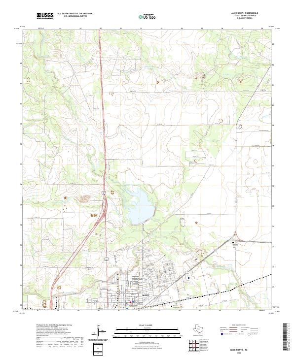
2022 Map of Alice North
USGS Topo · Published 2022About this map
The Jim Wells County Courthouse serves as the central landmark for the city of Alice, illustrating the organized street grid and civic center of this South Texas hub. The landscape is defined by the complex hydrology of the coastal plains, where intermittent watercourses like San Diego Cr and San Fernando Cr converge near the town's northern edge. Further north, the terrain remains primarily rural, marked by ranch roads and cattle operations such as Racer Ranch Rd and Coyote Ranch Rd. Genealogical interest is anchored by the Collins Cem and the Roberson - Collins Cem situated south of the main settlement. Distinctive landforms like the Resaca de Enmedio provide evidence of the region's ancient drainage patterns and the modern management of water in this semi-arid environment.
Find a feature on this map
94 named features on this map. Tap any name to fly to it.
Don’t see what you’re looking for? This feature index may not catch every label — zoom into the map to look around manually.
Map Details
Editions of this 2022 Alice North Map
This is the sole edition of this map. No revisions or reprints were ever made.
Other maps of this area

1917 · Ben Bolt
USGS Topo · 1:62,500

1920 · San Diego
USGS Topo · 1:62,500

1950 · Corpus Christi
USGS Topo · 1:250,000

1954 · Orange Grove
USGS Topo · 1:62,500

1954 · Kingsville
USGS Topo · 1:62,500

1956 · Corpus Christi
USGS Topo · 1:250,000

1956 · Laredo
USGS Topo · 1:250,000

1960 · Corpus Christi
USGS Topo · 1:250,000

1963 · San Diego NE
USGS Topo · 1:24,000

1963 · San Diego
USGS Topo · 1:24,000
Featured Places
- Alice, TX
- Howell Addition Colonia, TX
- Del Norte Mobile Home Park Colonia, TX
- Hollow Tree Estates Colonia, TX
- Kiesling's Colonia, Alice