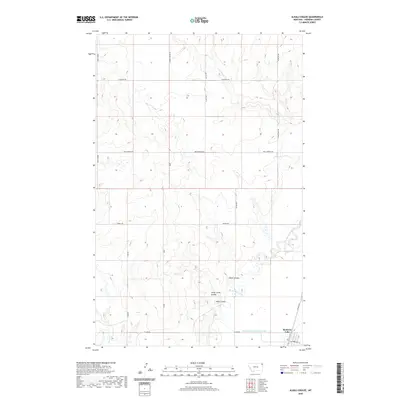
2020 Map of Alkali Coulee
USGS Topo · Published 2020About this map
Medicine Lake anchors the southeastern corner of this Sheridan County landscape, where the town's grid meets the serpentine path of Big Muddy Creek. This 2020 survey captures a vast prairie environment defined by its drainage patterns, with the wide, meandering creek bed served by Diversion Ditch Number One. The terrain is characterized by numerous coulees, such as Alkali Coulee and Sheep Camp Coulee, which carve through the high plains. A network of rural roads and tracks, including Burma Trl and Rock Springs Rd, provides access across the section lines of this agrarian region. To the north and west, the landscape is more isolated, marked by smaller watercourses like Otter Cr and Wolf Cr. The presence of Mine Coulee suggests the local history of land use in this part of Montana, reflecting the intersection of natural topography and human activity.
Find a feature on this map
22 named features on this map. Tap any name to fly to it.
Don’t see what you’re looking for? This feature index may not catch every label — zoom into the map to look around manually.
Map Details
Editions of this 2020 Alkali Coulee Map
This is the sole edition of this map. No revisions or reprints were ever made.
Other maps of this area

1914 · Homestead
USGS Topo · 1:62,500

1947 · Homestead
USGS Topo · 1:24,000

1948 · Homestead
USGS Topo · 1:24,000

1948 · Medicine Lake
USGS Topo · 1:24,000

1948 · Reserve
USGS Topo · 1:24,000

1948 · Alkali Coulee
USGS Topo · 1:24,000

1948 · Antelope
USGS Topo · 1:24,000

1949 · Reserve
USGS Topo · 1:24,000

1949 · Antelope
USGS Topo · 1:24,000

1949 · Alkali Coulee
USGS Topo · 1:24,000