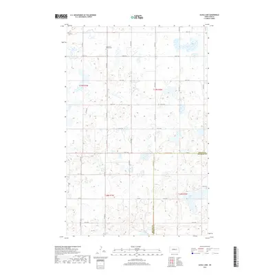
2018 Map of Alkali Lake
USGS Topo · Published 2018About this map
The prairie landscape of McLean and Sheridan Counties is defined by a rhythmic grid of rural section lines and glacial depressions. This 2018 survey captures the quiet agricultural character of the region, where the terrain is dotted with small wetlands and larger water bodies like Alkali Lake and Cherry Lake. For genealogists and local historians, the presence of the Seventh Day Adventist Cem and Tabor Cem serves as a tangible connection to the early families who settled this portion of the North Dakota plains. The map reveals how the modern transportation network, including Co Rd 35 and Co Rd 8, follows the established homesteading boundaries, illustrating the enduring legacy of the Public Land Survey System in shaping the state's geography.
Find a feature on this map
20 named features on this map. Tap any name to fly to it.
Don’t see what you’re looking for? This feature index may not catch every label — zoom into the map to look around manually.
Map Details
Editions of this 2018 Alkali Lake Map
This is the sole edition of this map. No revisions or reprints were ever made.
Other maps of this area

1929 · Kongsberg
USGS Topo · 1:62,500

1929 · Balfour
USGS Topo · 1:62,500

1945 · Pelican Lake
USGS Topo · 1:62,500

1947 · Pelican Lake
USGS Topo · 1:62,500

1947 · Turtle Lake
USGS Topo · 1:62,500

1954 · McClusky
USGS Topo · 1:250,000

1958 · McClusky
USGS Topo · 1:250,000

1958 · Butte
USGS Topo · 1:24,000

1958 · Balfour
USGS Topo · 1:62,500
1958 · Kief
USGS Topo · 1:24,000