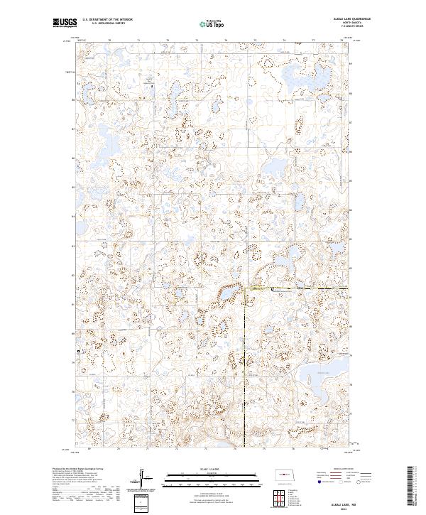
2024 Map of Alkali Lake
USGS Topo · Published 2024About this map
The prairie pothole landscape on the border of McLean and Sheridan Counties is defined by its extensive wetlands and conservation lands. The McLean County Waterfowl Production Area and the Sheridan County Waterfowl Production Area protect large tracts of this unique ecosystem, punctuated by the waters of Alkali Lake in the southeast. This geography reflects the agricultural and conservation priorities of central North Dakota, where the section-line road grid, including Co Rd 8 and Co Rd 35, navigates a complex network of small lakes and seasonal basins.
Find a feature on this map
24 named features on this map. Tap any name to fly to it.
Don’t see what you’re looking for? This feature index may not catch every label — zoom into the map to look around manually.
Map Details
Editions of this 2024 Alkali Lake Map
This is the sole edition of this map. No revisions or reprints were ever made.
Other maps of this area

1929 · Kongsberg
USGS Topo · 1:62,500

1929 · Balfour
USGS Topo · 1:62,500

1945 · Pelican Lake
USGS Topo · 1:62,500

1947 · Pelican Lake
USGS Topo · 1:62,500

1947 · Turtle Lake
USGS Topo · 1:62,500

1954 · McClusky
USGS Topo · 1:250,000

1958 · McClusky
USGS Topo · 1:250,000

1958 · Butte
USGS Topo · 1:24,000

1958 · Balfour
USGS Topo · 1:62,500
1958 · Kief
USGS Topo · 1:24,000