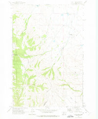
1971 Map of Alkali Lake
USGS Topo · Published 1975About this map
Springdale Colony sits on the eastern edge of this landscape, marking a localized pocket of settlement near the Alkali Lake basin. To the west, the terrain rises sharply into the timbered slopes of the Helena National Forest, where a complex network of drainage systems such as Woods Gulch and the North Fork Cooks Creek carve through the high country. This 1971 field-checked survey reveals the transition from the open lake-dotted flats of the Smith River valley into the protected forest lands of Meagher Co and Broadwater Co.
Find a feature on this map
21 named features on this map. Tap any name to fly to it.
Don’t see what you’re looking for? This feature index may not catch every label — zoom into the map to look around manually.
Map Details
Editions of this 1971 Alkali Lake Map
This is the sole edition of this map. No revisions or reprints were ever made.
Other maps of this area

1886 · Fort Logan
USGS Topo · 1:250,000

1886 · Little Belt Mts.
USGS Topo · 1:250,000

1894 · Little Belt Mts.
USGS Topo · 1:250,000

1897 · Little Belt Mts.
USGS Topo · 1:250,000

1898 · Little Belt Mts.
USGS Topo · 1:250,000

1902 · Little Belt Mts.
USGS Topo · 1:250,000

1948 · White Sulphur Springs
USGS Topo · 1:250,000
1951 · Black Butte Mountain
USGS Topo · 1:24,000

1958 · White Sulphur Springs
USGS Topo · 1:250,000

1961 · White Sulphur Springs
USGS Topo · 1:250,000