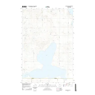
2014 Map of Alkaline Lake
USGS Topo · Published 2014About this map
Alkaline Lake dominates the central portion of this prairie landscape, serving as a primary hydrological feature at the intersection of Kidder and Logan counties. This 2014 survey captures a sparsely populated region of North Dakota defined by its glacial pothole lakes and a strict section-line road grid. The presence of Lake George in the northeast and Fresh Lake to the southwest highlights the varied water chemistry typical of this basin, where terminal drainage often results in the high mineral concentrations that give the namesake lake its character. The landscape is interconnected by a network of rural routes such as 44th Ave SE and 54th St SE, which trace the township and range lines through the undulating terrain of the Missouri Coteau.
Find a feature on this map
20 named features on this map. Tap any name to fly to it.
Don’t see what you’re looking for? This feature index may not catch every label — zoom into the map to look around manually.
Map Details
Editions of this 2014 Alkaline Lake Map
This is the sole edition of this map. No revisions or reprints were ever made.
Other maps of this area

1952 · Tappen South
USGS Topo · 1:24,000

1952 · Tappen SE
USGS Topo · 1:24,000

1953 · Jamestown
USGS Topo · 1:250,000

1955 · Medina SW
USGS Topo · 1:24,000

1956 · Jamestown
USGS Topo · 1:250,000

1975 · Medina SW
USGS Topo · 1:24,000

1983 · Streeter SW
USGS Topo · 1:24,000

1983 · Alkaline Lake SW
USGS Topo · 1:24,000

1983 · Alkaline Lake
USGS Topo · 1:24,000

1983 · Streeter NW
USGS Topo · 1:24,000