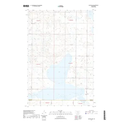
2017 Map of Alkaline Lake
USGS Topo · Published 2017About this map
Alkaline Lake and a series of smaller prairie basins dominate this portion of the Northern Plains along the border of Kidder and Logan counties. The landscape is defined by the section-line road grid, including 40th Ave SE and 54th St SE, which organizes the rural homesteads and agricultural tracts of the region. This 2017 survey reveals a persistent pattern of communal heritage through its small, scattered cemeteries, which often served the early immigrant families who settled these townships. These include the Zoar Evangelical Cem in the northwest and Friedens Cem to the east. The presence of Peace Lutheran Cem and Zion Reformed Cem further south underscores the area's denominational history. To the north and south of the central basin, Lake George and Fresh Lake provide additional landmarks in a terrain characterized by subtle elevation changes and glacial potholes.
Find a feature on this map
35 named features on this map. Tap any name to fly to it.
Don’t see what you’re looking for? This feature index may not catch every label — zoom into the map to look around manually.
Map Details
Editions of this 2017 Alkaline Lake Map
This is the sole edition of this map. No revisions or reprints were ever made.
Other maps of this area

1952 · Tappen South
USGS Topo · 1:24,000

1952 · Tappen SE
USGS Topo · 1:24,000

1953 · Jamestown
USGS Topo · 1:250,000

1955 · Medina SW
USGS Topo · 1:24,000

1956 · Jamestown
USGS Topo · 1:250,000

1975 · Medina SW
USGS Topo · 1:24,000

1983 · Streeter SW
USGS Topo · 1:24,000

1983 · Alkaline Lake SW
USGS Topo · 1:24,000

1983 · Alkaline Lake
USGS Topo · 1:24,000

1983 · Streeter NW
USGS Topo · 1:24,000