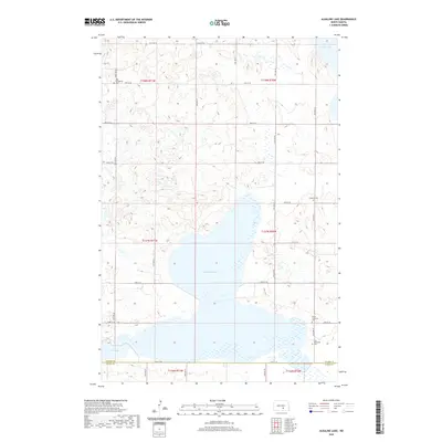
2020 Map of Alkaline Lake
USGS Topo · Published 2020About this map
Alkaline Lake dominates this central North Dakota landscape at the border of Kidder and Logan Counties. The map reveals a rural prairie environment defined by significant water bodies, including Lake George to the northeast and Fresh Lake to the southwest, separated by a grid of agricultural section lines and county roads. For those tracing family histories, several church and cemetery sites serve as key markers of the area's pioneer heritage. These include Zoar Evangelical Cem and the associated Zoar Evangelical church in the northwest, alongside Friedens Cem, Peace Lutheran Cem, and Zion Reformed Cem further south and east. The rectilinear road system, featuring routes like 40th Ave SE and 54th St SE, dictates the movement across this sparsely populated but historically significant corner of the Great Plains.
Find a feature on this map
31 named features on this map. Tap any name to fly to it.
Don’t see what you’re looking for? This feature index may not catch every label — zoom into the map to look around manually.
Map Details
Editions of this 2020 Alkaline Lake Map
This is the sole edition of this map. No revisions or reprints were ever made.
Other maps of this area

1952 · Tappen South
USGS Topo · 1:24,000

1952 · Tappen SE
USGS Topo · 1:24,000

1953 · Jamestown
USGS Topo · 1:250,000

1955 · Medina SW
USGS Topo · 1:24,000

1956 · Jamestown
USGS Topo · 1:250,000

1975 · Medina SW
USGS Topo · 1:24,000

1983 · Streeter SW
USGS Topo · 1:24,000

1983 · Alkaline Lake SW
USGS Topo · 1:24,000

1983 · Alkaline Lake
USGS Topo · 1:24,000

1983 · Streeter NW
USGS Topo · 1:24,000