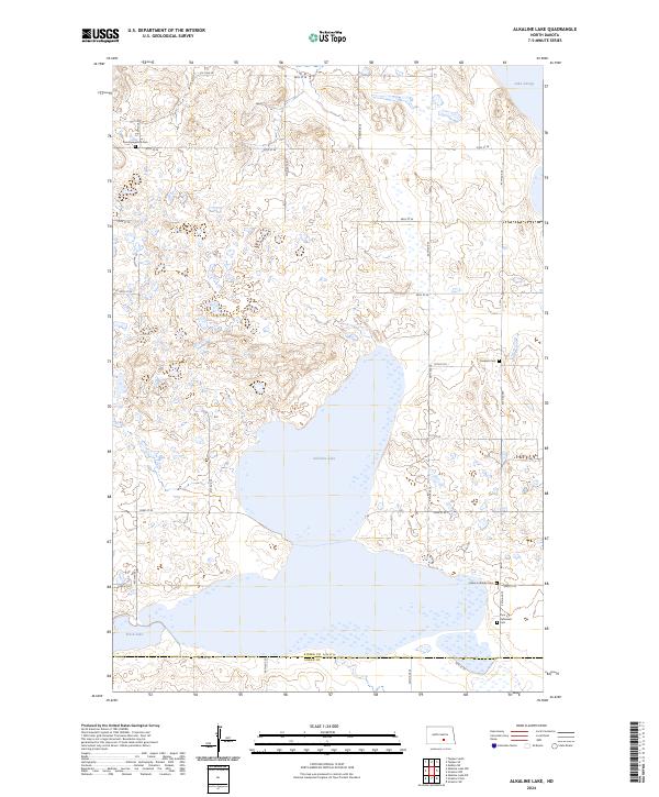
2024 Map of Alkaline Lake
USGS Topo · Published 2024About this map
Alkaline Lake dominates the central landscape of this Kidder County territory, surrounded by a complex system of seasonal wetlands and prairie potholes. The map reveals a deeply rooted rural community, evidenced by several denominational burial grounds including Zoar Evangelical Cem, Friedens Cem, and Peace Lutheran Cem. These small, localized cemeteries reflect the settlement patterns of early agricultural families in the region. The northern edge is protected by the Lake George National Wildlife Refuge, while extensive tracts of the Kidder County Waterfowl Production Area and the Logan County Waterfowl Production Area to the south manage the vital migratory habitats. The section lines are clearly defined by an organized grid of rural roads, such as 41st Ave SE and 54th St SE, which facilitate access across the Kidder and Logan County line near Fresh Lake.
Find a feature on this map
33 named features on this map. Tap any name to fly to it.
Don’t see what you’re looking for? This feature index may not catch every label — zoom into the map to look around manually.
Map Details
Editions of this 2024 Alkaline Lake Map
This is the sole edition of this map. No revisions or reprints were ever made.
Other maps of this area

1952 · Tappen South
USGS Topo · 1:24,000

1952 · Tappen SE
USGS Topo · 1:24,000

1953 · Jamestown
USGS Topo · 1:250,000

1955 · Medina SW
USGS Topo · 1:24,000

1956 · Jamestown
USGS Topo · 1:250,000

1975 · Medina SW
USGS Topo · 1:24,000

1983 · Streeter SW
USGS Topo · 1:24,000

1983 · Alkaline Lake SW
USGS Topo · 1:24,000

1983 · Alkaline Lake
USGS Topo · 1:24,000

1983 · Streeter NW
USGS Topo · 1:24,000