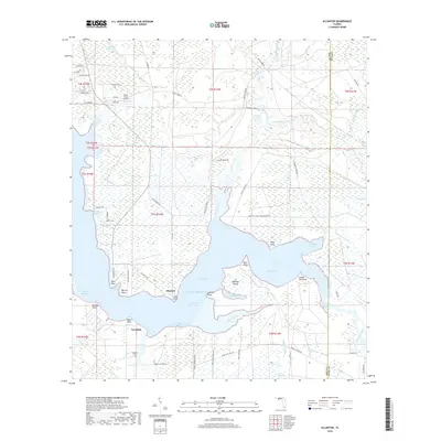
2018 Map of Allanton
USGS Topo · Published 2018About this map
Allanton and Farmdale sit at the edge of East Bay, where the coastline is defined by a dense network of inlets and low-lying wetlands. This landscape is shaped by the meeting of terrestrial drainage and the Gulf of Mexico, characterized by the presence of California Swamp and Bear Swamp alongside complex coastal features like Lathrop Bayou and Burkett Bayou. The transit corridor of the Intracoastal Waterway cuts through the bay, while the inland areas show a transition toward aviation-oriented development at the Sandy Creek Airpark. Genealogists and local historians will find the Farmdale Cemetery and various named points, such as Allan Point and Murray Point, providing specific geographic anchors for 21st-century property research. The map captures the interface between the Bay and Gulf county line and the winding course of Wetappo Creek.
Find a feature on this map
79 named features on this map. Tap any name to fly to it.
Don’t see what you’re looking for? This feature index may not catch every label — zoom into the map to look around manually.
Map Details
Editions of this 2018 Allanton Map
This is the sole edition of this map. No revisions or reprints were ever made.
Other maps of this area

1943 · Overstreet
USGS Topo · 1:31,680

1943 · Crooked Island
USGS Topo · 1:31,680

1944 · Beacon Hill
USGS Topo · 1:31,680

1944 · Long Point
USGS Topo · 1:31,680

1945 · Allanton
USGS Topo · 1:31,680

1945 · North Of Allanton
USGS Topo · 1:31,680

1945 · Wetappo Creek
USGS Topo · 1:31,680

1945 · Tenmile Swamp
USGS Topo · 1:31,680
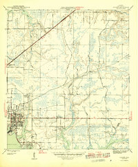
1945 · Parker
USGS Topo · 1:31,680

1947 · Allanton
USGS Topo · 1:25,000