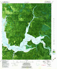
1982 Map of Allanton
USGS Topo · Published 1983About this map
Tyndall Air Force Base dominates the southern landscape of this coastal survey, where the heavy vegetation of the Florida panhandle meets the intricate shoreline of East Bay. The map captures a transitional period for small settlements like Allanton and Farmdale, which are situated along the north and south shores of the water. The Intracoastal Waterway cuts through the bay, serving as a primary maritime artery alongside natural features like Nesser Flat and Raffield Island.
Find a feature on this map
42 named features on this map. Tap any name to fly to it.
Don’t see what you’re looking for? This feature index may not catch every label — zoom into the map to look around manually.
Map Details
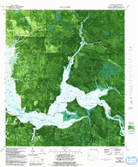
Editions of this 1982 Allanton Map
2 editions found
Other maps of this area

1943 · Overstreet
USGS Topo · 1:31,680

1943 · Crooked Island
USGS Topo · 1:31,680

1944 · Beacon Hill
USGS Topo · 1:31,680

1944 · Long Point
USGS Topo · 1:31,680

1945 · Allanton
USGS Topo · 1:31,680

1945 · North Of Allanton
USGS Topo · 1:31,680

1945 · Wetappo Creek
USGS Topo · 1:31,680

1945 · Tenmile Swamp
USGS Topo · 1:31,680
1945 · Parker
USGS Topo · 1:31,680

1947 · Allanton
USGS Topo · 1:25,000